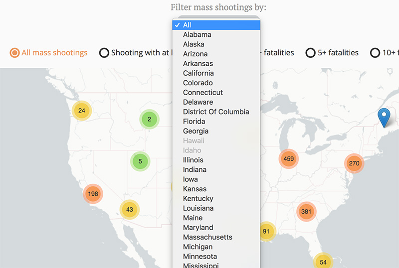
Readers can filter and permalink the mass shootings map by location and severity of the shooting.
This map uses custom javascript to ingest a regularly-updated JSON file and publish the information on a map of the U.S.
There is also custom javascript to let readers permalink any of the filtered maps, for easy sharing.
What I did
I worked with the designer-developer on the interactive team, who wrote the CSS and HTML.
I contributed:
- Custom javascript that managed the map and the form that readers used to explore the data.
- Documentation, including putting together the workflow for the monthly project updates.